Photo project and video, 2020
ARTERIES
On – in – between
the lines of the city
Photo project and video
during “Moving Lines” workshop by UniGe
by Federica Delprino
2020
The project was born during “Visuality_03” workshop for which I’ve been also a tutor.
“Moving Lines”, organized by University of Genoa, has been a collateral event of the LFA (London Festival of Architecture), connecting Genova, London and Paris via Teams.
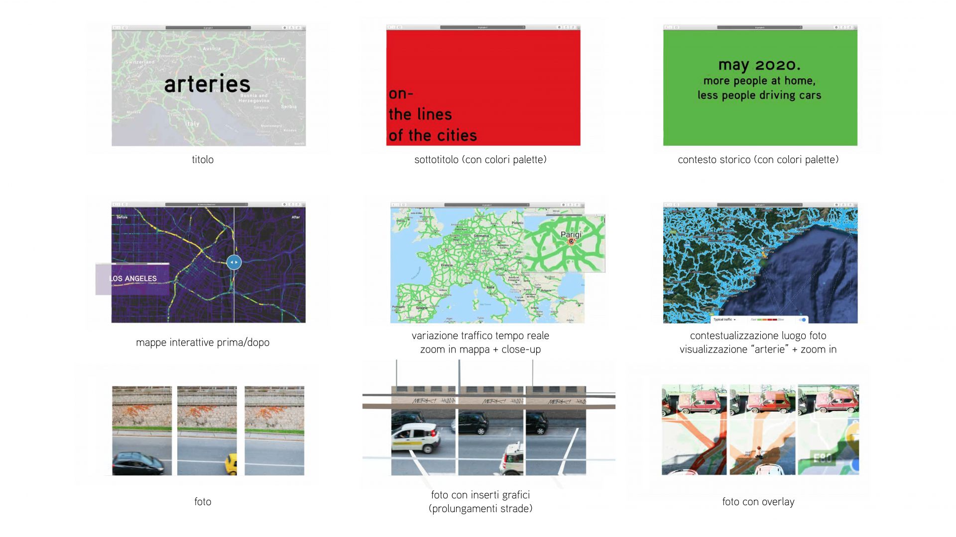
The photographic project “arteries” shows a series of shots from the window, which recall the traffic reduction following the lockdown situation. On the first hand, a very specific point of view is maintained: the city experienced by home; on the other, it’s also considered the overall view, the one of the streets changing their color and appearance from above (viewable thanks to Google Maps).
Chosen colors refer precisely to those that indicate traffic on digital maps: cities are greener in all senses.
On-in – between the lines of the cities.
The lines, either real or virtual, are the recurring element in all the pics. In addition to the compositional cohesion between the original photos proposed in the triad, this is made even more explicit by the overlay effect of the screenshots of the maps of Savona put in transparency on the images. The former is full of red lines, caused by traffic, and then goes from orange to green.
“Arteries” is a step of an artistic research started in 2015 aimed to investigate the theme of identity through “emotional maps”: maps of non-existent places, lines created from an overlap of places and images.
Reconsidering in a contemporary mindset the issues previously treated, I decided to start considering the (mental and physical) exploration of places and memories in a quarantine situation. The traced arteries were born as a response to investigate – and narrate – the appearance and evolution of Savona from a personal then objective point of view.
During the months in lockdown that hit more or less intensely the whole world population, the cities got emptier and emptier. How empty the cities should have looked, even from above!
Less traffic, less pollution. The streets were going back to being green – and not just where the nature reappropriated the places that had been removed from. The crucial points that before the lockdown were hopelessly congested had freed themselves from motorcycles, cars, horns. And the “traffic” function of Google Maps marked cities with green, free and accessible roads.
The inhabited areas changed rhythm, speed, ways of exploration. And from above they even change their appearance and color: they became green arteries.
These thoughts have also given birth to a video built to have fun exploring the world via Google Maps, with the traffic function active, so you can interactively see how the color of our planet has been changing from the last months of 2019 to 2020.
It’s interesting as well to visually perceive the difference between countries in total lockdown and those that haven’t stop that much. The colors of the world change, due to traffic, and simultaneously the mobility of people, the quality of the air everyone breathes, the habits, the perception of the outside.